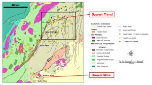
The mine is located 12.5 kilometers northwest of Asheboro and 11 kilometers southwest of Randleman in northwest Randolph Count, North Carolina.
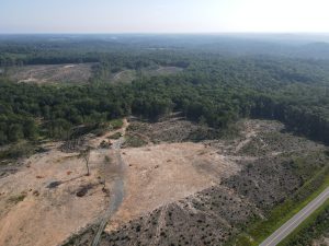
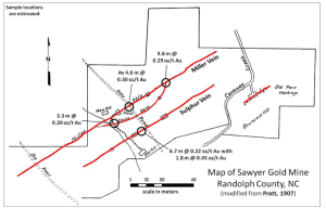
Carraway Creek runs through the property and the line of historic workings is intersected by road SR1004, with open cuts, portals, and drifts extending at least 150 meters to the WSW and ENE (Carpenter, 1976). Pratt (1907) reports that prospecting along the line of lode may have extended for 2500 meters. This deposit is designated as the type example for this style of gold mineralization in the Carolina Terrane in central North Carolina.
The mine was in operation prior to 1856 (Emmons, 1856) with workings along 5-6 parallel zones of strongly foliated Au-bearing silicified schist (Nitze and Hanna, 1896). The mine was active in 1902 (Pardee and Park, 1948) and a 46 meters deep shaft was completed on the Miller Vein around 1906, with six shallower shafts opened along other lodes (Pratt, 1907). The site was inactive by 1913 (Pratt and Berry, 1919), but some prospecting was reported as late as 1930 (Pardee and Park, 1948).
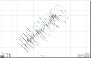
Several mining companies evaluated the Sawyer Mine during the mid-1970s to mid-1980s, including Phelps Dodge Exploration East, Goldfields, and Nicor. Two drilling programs totaling an estimated 5000 meters were completed by Goldfields and Nicor in the mid-1980s, including 6 core holes and approximately 20 reverse circulation holes. Available assays from the drill-holes include subsurface values of 0.02-0.20 oz/t Au over 0.75 meter intervals (MRDS record #10026505 ).
Romarco Minerals Incorporated announced the completion of 5 drill-holes at the Sawyer Mine in 2012. Multiple intervals of subsurface gold mineralization were intersected, most averaging about 1-3 g/t (0.03-0.09 oz/t) Au over intervals of 1.5-5.0 meters at depths of less than 25 meters. The best result was 10.7 meters (0-10.7 meters down-hole) averaging 4.5 g/t (0.13 oz/t) Au in vertical drill hole HKDH-11-003.
The mineralized lodes of the Sawyer Mine are developed in metasedimentary rocks of the Tillery Formation and variably described as strongly foliated silicified schists or slates (Nitze and Hanna, 1896; Pratt, 1907). Pratt (1907) noted that portions of the Sawyer lodes were extremely siliceous, including a part of the Miller Vein described as hard, laminated, quartz-rich, and similar to the Big Cut lode of the Russell Mine in the Ophir District in Montgomery County.


